Hook Logo

Overloaded state: UVA powers down to ease electric grid emergency

by Dave McNair

news-sun-i
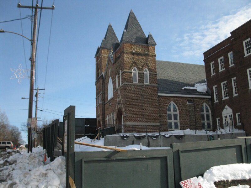
UVA powers down in the face of the sun.
PHOTOS BY JEN FARIELLO & IAN JAMES O’NEILL

A month ago, the University of Virginia conducted an “energy reduction” drill designed to reduce electric loads on its power grid in case of a declaration of an “energy emergency.” Today, the drill became reality.

“Yes, we’ve been informed that there is a real electric grid emergency in the Commonwealth of Virginia,” says Cheryl Gomez, UVA Facilities Management director of energy and utilities around 2pm Wednesday, July 7. “We’re initiating the load reduction plan as we speak.”

However, a spokesperson with Virginia Dominion Power disputes that, saying there is no grid emergency. More on that further down.

Gomez says that University officials received word earlier in the day from PJM Interconnection, an organization that monitors the flow of electricity in the Virginia Dominion Power region, that the current heat wave was causing an energy emergency on the state’s power grid, which could lead to rolling blackouts.

Gomez says it’s the first time the University had to implement the load reduction plan for real, but that during the two-hour drill on June 10, which tested the University’s ability to take loads off-line, they were able to reduce energy consumption by 2.96 megawatts. This time, however, Energy Connect has advised UVA to remain in an energy emergency for at least six hours.

Meanwhile, Gomez says a thermal energy storage tank has been brought on-line, which will offset the energy load by 1 to 2 megawatts, and that they’ve taken the main heating/cooling plant on Massie Road and another near a research facility off-line. The two plants will now run on diesel powered generators until the emergency is over.

Gomez also says that University faculty, students, and administrators have been asked to turn off all lights, computers, monitors, appliances, and any other devices not needed to do business.

If all goes as planned, Gomez expects UVA to take 6 megawatts off the power grid.

However, David Botkins, media relations director for Dominion, says the company wasn’t aware of any grid emergency. PJM, he said, could have made the call on its own.

“We haven’t broken any records yet,” he says, pointing out that the highest usage the company experienced was in August 2007. “There is high demand today, and we are encouraging conservation measures, but no emergency is in effect.” He suggested we call UVA Facilities Mangagement director Don Sundgren to confirm.

Sundgren, however, stood behind Gomez’s statements.

“We wouldn’t implement this on our own,” he says.

Updated 7.8.2010 9:24am

Local farmers feeling the heat

by Dave McNair
dish-asperagrasAsparagus pops out of the ground at the Food Hub’s Educational Farm at Maple Hill in April, but the recent heat wave has parched farmer’s fields. PHOTO BY EMILY MANLEY
While local foodies love their locally grown food, the people who grow it are not having an easy time of it in this hot weather, according to the DP’s Bryan McKenzie. “I just came in from the garden where nothing is growing and where I was tilling dust,” Corky Shackleford, 80, a Stony Point farmer, tells McKenzie. “Everything is brown. You’d think it was winter.” Indeed, the hot weather appears to be hurting farmers across the state. “One more week without rainfall and we will be in an extremely critical situation. All crops have stopped growing and are in survival mode. This includes all row crops, alfalfa and grass hay,” Jon Repair, of the Virginia Cooperative Extension Agency in Rockbridge County, tells the DP. Unfortunately, Jerry Stenger, director of the University of Virginia’s climatology office, says we’re in for more heat and little rain during the next two weeks.

COVERSIDE- Inside story: When a tree smashes your house

by Lisa Provence

cover-anoop-chelsea-westwoodAnoop Mirpuri and Chelsea Marie pack up to leave their ruined rental hosue.
PHOTO BY LISA PROVENCE

It was only later that Anoop Mirpuri considered, “I could have died.”

On June 24, Mirpuri was at his rental home in his upstairs office, preparing to defend his dissertation as a fellow at the Carter G. Woodson Institute. As the wind picked up, he decided to go downstairs and close the bedroom windows. That’s when he heard a loud noise.

“I thought it was an earthquake,” says the California-raised scholar. “I looked up, and the roof started cracking.”

The microburst that snapped trees all over Charlottesville had sheared off the side of the house he rents with his girlfriend on Westwood Road. Gone was his desk, his Macbook, and nearly his life.

I ran out and saw the tree,” says Mirpuri.

Four days later, a blue tarp is the only wall for the office and bedroom on that side of the house. Monopoly money, a GQ magazine, and a battered printer that were inside pre-storm now litter the yard.

cover-westwood-window-brAnoop Mirpuri had just closed the windows when the big oak hit.
PHOTO BY LISA PROVENCE

Thirty-one houses in town had trees crashing down on them in the June 24 storm, exceeding the 27 homes tree-bombed by Hurricane Isabel, a multi-day event, says Fire Chief Charles Werner.

Mirpuri and Chelsea Marie, who is wrapping up her post-doctoral work at the UVA Medical Center, are trying to pack what’s left of life in Charlottesville for a moving van coming in two days.

“Our neighbors have been great,” says Marie. “No one else has helped us.”

When she thought things couldn’t get any worse, Marie says a television station, running a story about the damage, gave the address of the house, which is owned by Hook culture editor Rosalind Warfield-Brown, and they experienced a dose of post-storm looting.

“Someone came and walked off with a new propane tank,” says Marie. “Sixty dollars is a lot to us now.” The couple doesn’t have renters insurance.

Good news came the following day when Mirpuri’s MacBook was found amid the rubble. Better yet, the computer came on. His dissertation secure, he plans to continue its defense as planned.

They’ve been staying with friends and plan to go forward with their move in a month to Drew University in northern New Jersey.

“We’ve rented a basement townhouse,” says Marie. “That sounds great right now.”
#

Snap o’ the day: Snapped

by Lisa Provence
snap-whale-tailThomas Givens’ sculpture is another microburst casualty. PHOTO BY LISA PROVENCE
The once-proud whale tail on the U.S. 250 bypass takes a fatal hit from the June 24 storm.

Storm stomps Lane Field

by Dave McNair
news-lanefeildA 100-foot tree crushed the facilities at Lane Field during the June 24 storm. PHOTO COURTESY LANE LEAGUE
Just a week after ACAC came to the rescue and announced it would fund the light bill for the Lane Babe Ruth League field on McIntire Road (after the County said it would no longer cover the expenditure), the Lane League was dealt another blow during the June 24 microburst. “During the storm one of the biggest oak trees on the hill uprooted,” writes League board member Robert Mullinax. “It fell into the light pole next to the concession stand, and both fell through the score booth/Board Room, over the fence, and down onto the field. The tree was around three feet in diameter and over one hundred feet tall. The damage is astounding.” Mullinax says that someone was in the score booth when the tree came down and narrowly escaped serious injury. Mullinax says the field was littered with parts of the oak tree, a utility pole, and broken lights. The fencing behind home plate will have to be replaced and the entire upstairs area over the concession stand will have to be rebuilt, as the score booth and file room are missing and the roof has been ripped off. The scoreboard controls, dugout phones, and sound system were also destroyed “There are pieces and parts of the building and its contents spread everywhere,” he says. The weekend after the storm the League was to begin 13-year-old All-Star games, but that has been canceled. However, the League, using other fields, was able to salvage the 14-year old Invitational and District Tournaments. According to League officials, County Parks & Rec director Tim Hughes has been to the field to assess the damage and begin filing an insurance claim. County crews will also be removing the tree. “The work will be prioritized, everyone will have a chance to help, and all will be put back in order,” says Mullinax. “And while we have always taken pride in the excellent facilities at Lane Babe Ruth, kids can play baseball without a Board Room.”

Another microburst fells trees (and tosses umbrella)

by Hawes Spencer

news-prestonavenueumbrellaAn umbrella tumbled down Preston Avenue.
PHOTO BY HAWES SPENCER

Update: SLIDESHOW.

One of the hottest days of the year delivered Charlottesville a tree-smashing, traffic-stopping microburst Thursday. Drivers had to dodge sideways winds, tumbling limbs, and moments of hail as the storm struck just before 5pm.

Rio Road is said to be grid-lock, and so is Georgetown Road. There are even— according to callers on Coy Barefoot’s WINA radio show— problems on Interstate 64. The right westbound lane near the Fifth Street Exit has a tree on it, according to a caller

img_4408This tree was uprooted along Rose Hill Drive.
PHOTO BY HAWES SPENCER

WINA’s own property on Rose Hill Drive is the site of an uprooted evergreen tree as well as an another evergreen snapped like a toothpick.

– developing—

On Holmes Avenue, there’s a tree atop a house, according to a caller.

Roads with giant problems:

- Alderman

- Route 250 Bypass between Best Buy and Ivy Road Exit

- North Avenue due to fallen utility pole

- Georgetown Road

- Hinton Avenue in Belmont, site of fallen utility pole

Heavy rain expected tonight

by Hawes Spencer
news-weatherfrontapproachingFrom the big looping map… NATIONAL WEATHER SERVICE
You better toss that Nerf ball with the kids this afternoon because waiting may mean wetting, as a big low pressure system comes crawling over the mountains some time this evening. The National Weather Service provides a hazardous weather outlook, and Charlottesville Fire Chief Charles Werner finds himself watching this big looping map.

We’re under a tornado watch until 8pm

by Hawes Spencer
This is what the National Weather Service says. Good thing it’s daylight so you might see the funnel cloud before it picks up your house. Don’t panic, but don’t ignore.

Snap: Rugby Avenue closed due to wires

by Hawes Spencer
news-rugbyaveclosedHere is the caption. PHOTO BY HAWES SPENCER
Rugby Avenue, one the prime entrance/exit points for the U.S. 250 Bypass as well as a gateway to McIntire Park, was closed after the big June 3 microburst due to fallen power lines, which were getting repaired at the time of this 5:08pm Thursday image.

10,000 powerless, weather creates havoc

by Lisa Provence
microburstnasaDramatization of a microburst. IMAGE BY NASA
5:54pm update: Hail was falling at the speed of rain in the Barracks Road area during the storm. 5:52 update: Barefoot, citing Charlottesville Fire Chief Charles Werner, says that we may have experienced a microburst. 5:42 update: The tree that was blocking Route 20 near Carter’s Bridge has been cleared, according to one WINA caller; and Route 20 is clear all the way north to Proffitt Road, according to another one. 5:37pm update: The 250 Bypass Eastbound has slowed to a crawl/standstill, according to WINA’s Rob Graham calling in to the Coy Barefoot show. 5:32pm update: With 54 locations and 10,000 customers without power, the power may not be restored until 10am, says WINA news broadcaster Jaclyn Piermarini, relaying information from Dominion Virginia Power. ——— The storm that passed through around 3:30pm today trapped a woman in her car when a tree fell on top of it on the Dairy Road offramp, according to an emergency communications dispatch. Traffic is snarled on the U.S. 250 bypass with McIntire Road blocked and tree limbs all over the place. “It looks like a tornado went through,” says motorist Richard Lloyd, trying to cut through Rugby Road. Another caller reports that power is out in Ivy, as are stoplights on the west side of town. A severe thunderstorm watch is in effect until 9pm. original headline: Weather creates havoc

Snap: A river runs through McGuffey Park

by Hawes Spencer
news-raininmcguffeyparkThe park got a $679K renovation in 2007. PHOTO BY HAWES SPENCER
Right around the time that the Fridays After Five concert was supposed to be taking place on May 28th, the rainstorm that dropped 1.5″ of water in relatively short order not only canceled Fridays After Five (which was to have featured the home-grown Indecision), but the rain also turned this staircase at McGuffey Park into something of a waterfall.

Snap: Dark sky over Water Street

by Hawes Spencer
news-waterstreetYork Place, the Terraces, the Commerce Building, the Landmark, and the Live Arts building. PHOTO BY HAWES SPENCER
A somewhat forbidding sky looms over Water Street— including its most controversial component, the unfinished Landmark hotel— in an image captured at 6:14pm Sunday, May 23. However, no rain fell that date.

Snap o’ the day: No problems here

by Lisa Provence
snap-fri-after-5-stormHeavy rains, high winds, lightning and thunder did not stop the Iguanas from sizzling at Fridays after 5 on May 14.

Snap o’ the Day: Springtime for Robert E. Lee

by Lisa Provence
snap-robert-e-leeThe General almost seems to tiptoe through the tulips in Lee Park.

Snap: UVA Lawn teems with sun-lovers

by Hawes Spencer
news-uvalawn-warmweather The UVA Lawn teemed Wednesday with Frisbee throwing and other revelry, as the sky was blue, the high temperature reached 76 degrees, and shorts and flip-flops were seen in abundance. (Thursday may be even warmer, with the National Weather Service calling for a high near 80.)

Snap: Spring in Belmont

by Hawes Spencer
news-snap-springbelmont Spring shows in the form of Stonehenge Avenue daffodils, or jonquils as some like the call these floral harbingers (but technically called Narcissus), in the Belmont neighborhood. Saturday’s weather will continue sunny, but clouds are expected Sunday with showers Monday as a front moves in. (photo by Don Neuland)

Tuesday’s snow won’t be much

by Hawes Spencer
The snowfall predicted for Tuesday night shows little chance of accumulating more than an inch or so, as none of the winter weather maps produced by the National Weather Service show any chance of four inches, even on the mountains, in this vicinity.

Extremely high winds expected tonight

by Hawes Spencer
news-windadvisory10am Friday update: Only 49 Albemarle customers of Dominion Virginia Power are out-of-power this morning, according to an online outage map, so it looks like last night’s wind storm didn’t pack as much punch as feared. Forget the snow; the National Weather Service is now warning that areas around Charlottesville could see wind gusts up to 50mph tonight and 55mph Friday— and up to 60mph a bit to our south. If the Service is right, citizens might want to batten down for a new round of power outages.

‘Monster’ snowstorm appears to miss us (mostly)

by Hawes Spencer
news-accuweathersnowmap4:38pm Wednesday update: Well, it looks like we’ll start with some rain and then get around an inch of snow overnight, according to the latest from NWS. What the folks in New York and New England will get, however, is the “Snowicane,” as some are calling it, with one to two feet of snow plus wind gusts that could hit 70mph. Yowsah! (And There’s already a Wikipedia page on this one.) —- Weather maps created by Accuweather show a “monster” snowstorm poised to strike the Northeast overnight tonight and Thursday, and although some of Virginia’s northwesternmost mountains are expected to get some of the fluffy precipitation, the bulk of the storm appears to be missing the Charlottesville area, with the National Weather Service predicting just a 50 percent chance of snow here. Can’t get ‘em all!

Don’t flee to Florida yet, but…

by Hawes Spencer
news-accuweather-snow-map9:36am Saturday update: DOWNGRADED to a rain prediction with a mere chance of freezing rain Monday morning. 6:38am Friday update: “WHILE THE MAJORITY OF THE PRECIP LOOKS TO BE RAIN… THE LOW LEVEL AIR MAY BE COLD ENOUGH TO SUPPORT A WINTRYMIX… PARTICULARLY ACROSS NORTHERN SECTIONS [OF VIRGINIA]…”–NWS

4:01pm Thursday update: To go with its story on the advancing storm, Accuweather has put up a scary map. (Scary to parents of education-starved children, that is.)

Original post: Meteorologists with the National Weather Service indicate that a new storm sweeping in from the West brings the chance for snow this Sunday night, as the fine print in the northern Virginia weather station’s long-term discussion would indicate.

5 citations: Charlottesville Police begin enforcing citizen snow removal

by Lisa Provence

news-sidewalk-omniWhere the sidewalk ends: Water Street on February 17, just past the federal courthouse.
PHOTO BY LISA PROVENCE

Charlottesville Police have gotten tough on businesses and individuals who have not removed snow from public sidewalks, and issued five summons for noncompliance with the city’s snow removal ordinance.

McDonald’s, Wendy’s, and Yellow Cab got tickets February 11, and individuals in the 1700 block of JPA and in the 700 block of Monticello were written up this week.

“We’ve received over 150 complaints,” says Lieutenant Gary Pleasants. “The majority were warned, and most complied.”

Since the December snowpocalypse, police have come under fire for not enforcing the sidewalk ordinance, which requires that residents clear walkways within 12 hours after snowfall ceases.

At the end of January, Chief Tim Longo admitted that (more)

Students make mirth at Mt. Chipotle

by Hawes Spencer
news-snow-thur-chipotleA story in the Progress shows how this peak near Chipotle restaurant in Barracks Road Shopping Center— photographed and named here on Christmas Eve (when it was smaller)— has become the center of a beverage-fueled betting pool among UVA enviro students who set up a website to monitor their favorite snowy mass.

‘Not my responsibility’ No-plow-zone finally gets plowed

by Lisa Provence

news-roys-plowRoy’s Place gets a Valentine– its first plowing of the season on February 13.
PHOTO COURTESY CHRISTINE CORNWELL

The cul-de-sac that Charlottesville city crews won’t plow because of a dispute with the developer got mechanically scraped for the first time this season, but negotiations to get the neighborhood off the city’s  no-plow list remain at a stalemate.

“I’m going to move the snow tomorrow,” says developer Bobby Banks on February 12. “Not to say I’m responsible. The people there deserve better.”

The residents discovered their legal limbo during the December 18-19 Snowpocalypse when the city said its crews wouldn’t plow Roy’s Place because the developer had not properly (more)

Don’t scream: More snow coming…

by Courteney Stuart
news-scream
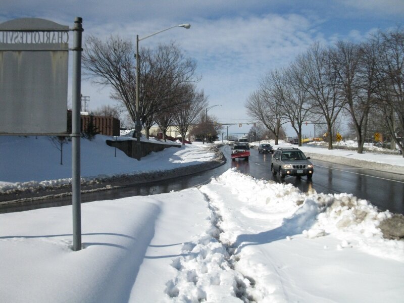
If you’ve turned on the TV, talked to another human being, or checked Facebook in the last 24 hours, you’ve probably heard the rumor that more snow’s on the way. Alas, it’s true– but it could be so much worse. State climatologist Jerry Stenger says a light dusting is possible tonight, Friday, February 12, and that Monday, February 15 brings the chance of an additional one to two inches of snow thanks to a storm coming in from our west. Unlike recent classic Nor’easters, which pick up moisture from the Gulf of Mexico, reorganize when they hit the Atlantic, and dump boatloads of precipitation up the East Coast, Monday’s storm is moving in from the Mid-West and shouldn’t be too disruptive. “These storms tend to be comparitively dry,” he says, noting the snow will likely start sometime Monday morning and could last until midnight. Stenger says he doesn’t see any other big storms likely over the next 10 days, although he acknowledges that could change. “Anything outside five days,” he laughs, “is pretty much a Ouija board.”

Snow may help farmers

by Hawes Spencer
According to the lead paragraph (the rest of the story is hidden behind a firewall) of an article in the Harrisonburg newspaper, the snowfall that’s vexing school systems may end up benefiting the people who grow crops for a living.

Snowiest winter ever– in 125 yrs.

by Lisa Provence
news-rotunda-snowToday’s snowfall of 3.8 inches breaks by 3/10ths of an inch the record previously held by the winter of 1995-96 with 54.7 inches, according to McCormick Observatory, Charlottesville’s official weather station since 1894. The latest white stuff puts us at 55 inches for the season, and Punxsutawney Phil says we’re getting at least six more weeks of winter. However, UVA climatologist Jerry Stenger says we’ll be lucky if it’s only six more weeks. Before the observatory, Thomas Jefferson recorded 36 inches during one storm in 1772 during the “Little Ice Age.”

Got wood? Too late to warm with a cord

by Courteney Stuart

news-firewoodIf you don’t have it already, you’re probably out of luck.
PHOTO BY HORIA VARLAN/FLICKR

During most Charlottesville winters, a fireplace is a pleasant but unnecessary home accessory that provides cozy warmth— and maybe a little romantic ambiance. But this year, some families who suddenly lost power began looking to their hearths as a primary heat source. The problem is it’s too late to buy firewood. At least in any significant quantity.

“Normally, we have some to keep people going,” says William Frye of Ruckersville based Frye’s Firewood. “This hasn’t been most years.”

Like most firewood sellers, Frye has regular customers who stock up in the fall. Since the February 5-6 storm, which knocked out power to thousands of area homes, Frye says his (more)

Weather watch: Sun’s out, but don’t get your hopes up (12:25pm Tuesday)

by Courteney Stuart

news-snow-treesdownTree took out power lines during the storm February 5-6. Tonight’s storm offers more of the same.
PHOTO BY CHARLES WERNER

12:35pm: Yes, the sun’s out after a few flurries this morning. No, that doesn’t mean we’ve dodged the snow. That’s the latest from the Sterling weather station, where meteorologist Richard Hitchens says Charlottesville’s still slated to get five to 10 inches of white stuff by Wednesday morning. In addition to the impending snow, which is already falling to the south and west of us, this storm system’s bringing winds– 15-25mph sustained with possible gusts between 30 and 40mph, particularly along ridgetops. For those whose power has recently been restored, now’s the time to take a shower and heat up the house (then keep your doors and windows shut). Hitchens warns that with the predicted conditions, further power outages are likely.

No plow zone: The street that may never get scraped

by Lisa Provence

news-noplowzone-roysplaceAn ambulance made it onto unplowed Roy’s Place during a recent light snow, but residents are fearful.
PHOTO BY HAWES SPENCER

What if you lived in Charlottesville, paid your taxes, but still found yourself living where public snowplows won’t go? Residents of one city neighborhood say that’s the situation they’re facing because of a dispute between the developer and the city.

After two feet of snow fell in December, residents of the 16-house subdivision known as Roy’s Place eagerly awaited snowplows. They heard one scraping on nearby Hartman’s Mill Road and Rougemont Avenue. And then it moved on.

And that’s when they learned of their legal limbo. According to residents, Roy’s Place has never (more)

Powerless: Trees down, irritation level rises

by Lisa Provence

news-tree-downHeavy snow, saturated soil and high winds wreaked havoc on area trees.
PHOTO BY CHARLES WERNER

Between Friday and Saturday night during last weekend’s not-quite-a blizzard, 40,000 Dominion Power customers’ lights went out in the Charlottesville area. The other major power provider for Albemarle County, Central Virginia Electric Cooperative, had between 11,000 and 13,000 households— one third of its members— sitting in the dark.

When such widespread, misery-inducing outages occur (like Hurricane Isabel in 2003), the perennial question pops up: Why aren’t the power lines buried?

“It costs six times more to put power lines underground,” says (more)

6% of Dominion’s Albemarle customers w/o power, more snow coming! (4:24pm Monday update)

by Hawes Spencer

snow-tuesday4:24pm Monday update: Dominion has reduced its number of Albemarle powerless by nearly 1,000 since our last count to bring the total to just 2,355. Meanwhile, the National Weather Service points out that there’s a “higher than normal” uncertainty in the weather models, so there’s actually a chance this area will get little or no snow during tomorrow’s event. What’s more certain, however, are the aforementioned high winds.

4:10pm Monday update: [youtube width="200"]yTtTxv6dKEo[/youtube]More snow video. Nothing dramatically newsworthy here. Previous snow videos.

12:16pm Monday update: According to this nifty interactive map (which most unpowered households can’t possibly see), 3,259 of Dominion’s 39,262 Albemarle customers remain without power at this moment. That’s 8 percent of the company’s County electric buyers.

8:35am Monday update: The map doesn’t lie. Snowfall of greater than five inches is possible in the Charlottesville area, says Kevin Witt, a meteorologist in the Sterling, Virginia weather station. Witt says we can expect sustained winds of 25 mph with gusts up to 30 mph in addition to the snow, which is expected to start mid-morning Tuesday. Unlike the last storm, fortunately, this one isn’t expected to peak in strength until it’s well off the coast.  Still, Witt predicts “a travel mess” and possible further power outages, particularly with strong winds after the snow ends. Sigh…

6:43am Monday update: Well, just when you thought it was safe to get back to normalcy… another snow storm appears likely to dump 3-6 inches here on Tuesday afternoon or evening. Check out this National Weather Service map, which indicates that although the sweet spots— shown in red— lie north of us, we are clearly in the projected snow zone. (And many of us still don’t have power.)

6:22pm Sunday updates: Albemarle County has already called it: NO SCHOOL TOMORROW. Also, emergency officials are asking drivers who are available on Monday to call 979-9912 to volunteer their services.  (The 979-INFO line will close tonight at 9 o’clock and will reopen tomorrow at 6am for a period of time yet to be determined.)

6:10pm Sunday update: According to WINA 11,700 Dominion customers in our area are still out, and 9,000 Central Virginia customers, for a total about 20,000 customers locally in the dark. At the peak, there were 35,000 places without power. That’s an enormous proportion of local customers and may constitute a record. This large an outage— particularly when there are many small outages within subdivisions— will not be cured overnight.

1:02pm Sunday update: Dominion Virginia Power says its crews are working overtime to get power back to the thousands without it. Meanwhile, County spokesperson Lee Catlin says (more)

Light snow: 2-5″ expected today (w/new video)

by Hawes Spencer
[youtube width="320"]qYB1ckVDhL4[/youtube]The National Weather Service predicts an additional two to five inches of snow today. (At the Hook weather station near Ivy, it’s been snowing steadily since around 8:30am with a temperature of 33 degrees.) Hook journalist Hawes Spencer, who documented shopping opportunities Friday morning, went out again Friday afternoon to see what was going on. Video at left. As for whatever happened to the 20-28″ Snowmageddon blizzard that didn’t quite materialize, feel free to discuss here.

Annals of snow: Dude, where’s our blizzard?

by Hawes Spencer

news-blacksburg-snowmapOne National Weather Service station indicates more snow— but not much.
NWS/BLACKSBURG

So Saturday has almost dawned, and no doubt there are 13,000 very unhappy, power-deprived households right now, but the predicted near-blizzard and its expected record snowfalls and high winds haven’t materialized. At the Hook weather station near Ivy, it’s been lightly raining/misting all night, the temperature is 31, and whatever trace of wind may exist doesn’t even register on our little weather machine. Even the National Weather Service, the folks previously predicting 20-28 inches of blowing snow, have issued a far tamer (but potentially contradictory) report for today. The Sterling office of the Service says we’re to stay under storm watch until 10pm but to expect just one inch of snow, which quits at 7am. (Read it yourself, and see if a report supposedly issued at 4:05am Saturday and mentioning winds “tonight and Saturday” makes sense.) The more assertive Blacksburg office of the NWS has created a snowfall map that— although putting Albemarle slightly outside its bounds— appears to suggest that we’ll get 3-4″ today. And yet another NWS office has created this multi-color map. This all bolsters UVA’s decision to move forward today with its men’s basketball game against Wake Forest.

Shelter open: Worst conditions expected after sunset (updated 7:24pm)

by Hawes Spencer
7:24pm update: Dominion Virginia Power spokesperson Dan Genest just told a radio audience that 5,700 Central Virginia customers are now without power and that the rest of us should be prepared for a potential multi-day outage. 7:15pm update: Although some mixed precipitation has been observed around the area, according to a meteorologist in the Sterling weather center, it’s not going to last. Snow will pick up again in the evening hours with an expected accumulation of 12-16″ overnight and a total expected accumulation for the Charlottesville area now over two feet. 5:22pm update: Due to lots of fallen limbs and trees, Catlin urges anyone driving to carry a chainsaw and seeks members of the chainsaw-wielding public to assist the Emergency Services staff to help clear such blockages from roads. “We are seeing an increase in the number of power lines down calls,” Catlin says in a release, “a total of about 800 local customers without power according to Dominion Power.” *** For those without heat, a regional shelter opened at noon today at Monticello High School, according to Albemarle County spokesperson Lee Catlin, who notes that it will be staffed by Social Services, the Red Cross, the Health Department, and the County Sheriff’s Department. Catlin also notes that authorities have issued a call for drivers of four wheel drive vehicles to volunteer for emergency transport duty, and anyone interested should contact 979-INFO. Heavy snow and high winds up to 25mph are expected tonight rendering travel unwise if not impossible. Although a Hook reporter just made the trek from downtown to Ivy around 4pm, and even though we find such driving enjoyable, non-essential travel is not advised. An updated National Weather Service report suggests that today’s approximately six-inch snowfall is a mere presage to near-blizzard conditions tonight. (Were it not for the near-arctic meteorological definition of a blizzard— requiring winds at least 35mph— this Snowmageddon would be a blizzard.) Meanwhile, climatologist Jerry Stenger was just heard interviewed on WINA radio talking about widespread– not just higher elevation– snow depths over 30 inches.

Shovel stampede: Shoppers make last-minute buys amid flakes

by Hawes Spencer

[youtube width="320"]dr5fK6YNpDM[/youtube]A journalist decided to roam from Charlottesville business to business this morning in the opening hours of Snowmageddon to see how shoppers and managers were dealing with lovely little flakes— which will grow in intensity tonight and tomorrow into a record-challenging, or even record-breaking, blizzard.

Since every school system— including the almost-never closed UVA is closed today— as well as most businesses, the Hook would like to publish a running list of things that are OPEN. (Feel free to email with additions, and you may also telephone us at 295-8700×230)

The Free Trolley
The Haven - (the place with the snow shoveling guys) - 973-1234
Bodo’s - downtown
Bodo’s - Corner
Bodo’s - Emmet
Reid Super Save Market
Bellair Market - Ivy Road
Café Cubano - Downtown Mall
Fardowner’s - Crozet
Shenandoah Joe - Ivy Road
Martin Hardware - Preston Avenue
Suds laundromat - Preston Avenue
7-Eleven - Ivy Road
Shell station - Ivy Road
Shell station - Preston Ave

Integral Yoga Natural Food - Preston Avenue

Durty Nelly’s - JPA

Market Street Wine Shop

Riverside Lunch

Boylan Heights - on the Corner
Miller’s - Downtown Mall
Ventana - Downtown Mall
Maya - West Main Street

Earlysville Market

Wahooptie is working in the snow tonight in case people need a ride home:  249-TAXI

Beer Run - Belmont
Bel Rio - Belmont
Rapture - Downtown Mall

Shell - Pantops

UVA men’s basketball game with Wake Forest - noon Saturday

13,515 out: Power outages skyrocketing (5:29am update)

by Hawes Spencer
news-electric-power-down5:23am Saturday update: As snow- and ice-coated tree limbs crash down on overhead electric wires, 13,515 customers in the Central Piedmont and Shenandoah Valley find themselves withou electricity from Dominion Virginia Power, the area’s largest utility company. 7:26pm Friday update: At least 250 (and perhaps as many as 250) households and/or businesses are already without electricity this morning, according to an outage map provided by Dominion Virginia Power. And Snowmageddon has not yet begun to rage. 2:36pm update: When this story was first posted at 11:05am, the map was showing no more than 50 outages, but now it’s over 250. Uh, oh. 7:24pm update: Dominion Virginia Power spokesperson Dan Genest just told a radio audience that 5,700 Central Virginia customers are now without power and that the rest of us should be prepared for a potential multi-day outage. --original headline: At least 50 out: Charlottesville power outages have begun

Snow hits Roanoke, heading this way

by Hawes Spencer
snow-roanoke A Valley newspaper’s webcam shows that the impending snowstorm has reached Roanoke, which means it will soon arrive in Charlottesville, and a 5:19am dispatch from the National Weather Service reiterates what was released yesterday: 18-28 inches of snow predicted for Central Virginia with higher accumulations— exceeding 30″— at higher elevations. The snow appears gentle thus far on the Roanoke Times‘ webcam, but the Weather Service warns of heavy snowfall this afternoon and “near-blizzard conditions” at the height of the storm on Saturday.

Weather update: Even worse

by Courteney Stuart
The forecast is getting worse, with a meteorologist at the Sterling weather station revealing all storm models are now “insisting” that Charlottesville’s in for at least 20 inches and as many as 28 inches of heavy, wet snow starting at 6am Friday and continuing until 10pm Saturday. Making matters worse, says meteorologist Stephen Konarik, strong winds up to 30mph are possible, particularly during the storm’s peak hours, overnight Friday into Saturday morning. That’s just 5mph slower than what’s needed to classify a snowstorm as a blizzard and plenty strong, Konarik says, to bring down tree limbs and with them, power lines. The one bit of good news Konarik offers: Charlottesville isn’t likely to see any icy precipitation, which will be limited to areas south.

Pandesnownium: Charlottesville shoppers go mad before storm

by Courteney Stuart

news-blizzardshopping-handHere we go again…

They’re not looting just yet, but shoppers panicked by one weekend’s impending whopper of a storm were swarming stores like locusts, leaving shelves barren in their wake.

Lowe’s sold 1,000 shovels yesterday, February 3, and smaller hardware stores are doing an equally brisk business.

“We sold 400 shovels in two hours yesterday,” says Rosemary Johnson at Martin Hardware on Preston Avenue. Sleds, rock salt and flashlights were disappearing, Johnson says, although a shipment due Friday morning of 1,000 shovels and other wintery items provides hope for late-comers (assuming they can reach the store before the roads become impassable).

Across Preston Avenue at Reid Super Save Market, “It’s been crazy for several days,” says assistant manager Kim Miller, adding that supplies, particularly milk and bread, are running low. Like Martin, the store expects a morning delivery to replenish shelves and fill pantries. “It should be here by 7am,” she says, “we’re hoping before the snow.” (more)

From the archives: What’s in your winter survival kit?

by Dave McNair
Mike Jarrell of Martin Hardware and Ronnie Kite of Meadowbrook Hardware have given Hook readers advise about winter preparedness in the past. With the approaching storm, we felt it was time to dust them off.

No parking on major streets after midnight

by Lisa Provence
In anticipation of heavy weather, Charlottesville wants parked cars off main thoroughfares by midnight. Water and Market streets between Ridge and 10th, East Jefferson, West Main and High streets all become no parking zones at midnight, and parked cars will be towed. The city offers free parking at the Water and Market street garages, and requests that residents not park on the street if possible to make it easier to clear side streets.

Updated Hook weather reports

by Dave McNair

“Snowmageddon” is definitely on its way. Here’s the latest report from the Hook newsroom. Be sure to check in here for updated reports like this throughout the day and tomorrow.

Snap: Calm before the (big) storm

by Hawes Spencer
news-rotundasnapWith a moisture-laden low pressure system hovering off the East Coast, a frigid air mass moving down from Canada, and a whopper of a storm system picking up Gulf moisture as it steadily moves east, the sweet spot of the storm is going to create havoc. Here’s the UVA Rotunda Thursday the 4th of February at 7:41am.

Snap: UVA students defy the snow

by Hawes Spencer
news-uva-students-attend-snow UVA students defied an overnight snowfall of three or four inches to attend their classes on Wednesday morning. So why can’t the other Charlottesville and Albemarle students?

Snap: Jefferson Theater snowball fight

by Hawes Spencer
news-jeffersontheater-snowball A light-hearted snowball fight breaks out tonight around 8:30pm in front of the Jefferson Theater, the 1912 palace of movies and mirth that reopened last Thanksgiving.

Snowmageddon: Friday in Charlottesville ‘could get ugly’

by Lisa Provence

news-weekendsnowforecastWe’re in the deep snow belt (shown in blue), but don’t believe the hype beyond this AccuWeather map from Wednesday morning.
ACCUWEATHER

Punxsutawney Phil could be right. The National Weather Service predicted a 100 percent chance of snow Tuesday night with four to six inches possible. (We got about three.) But this weekend is bringing so much precipitation that UVA climatologist Jerry Stenger says, “It could get ugly.”

When asked about rumors of a 20-inch snowfall for the February 5-7 weekend, Stenger replies, “The models have been suggesting something like this (more)

Snap: Striped road for snow

by Hawes Spencer
news-snowstripesSpeak softly and carry… a lot of deicing compound that you can stripe on the roads. That seems to be the mantra of VDOT this time around. In anticipation of a snowstorm, this is how Route 29 looked at Polo Grounds Road Friday morning at 9:17am.

Mo’ snow: Sidewalks clearer in Jan than ’snowpocalypse’

by Lisa Provence

news-ridgewestmainThree weeks after Snowpocalypse, this sidewalk at the major intersection of Ridge and West Main was impassable in a wheelchair.
PHOTO BY KEVIN COX

For weeks after December’s massive volume of snowfall ceased, snow remained on sidewalks in violation of Charlottesville’s City Code and causing frustration for both able and disabled citizens who use sidewalks.

The latest 10.5 inches officially recorded at McCormick Observatory for the January 30 snow brings a different grade to city efforts: much improved.

“The city has done a (more)

Snap o’ the Day: Waterways crest their banks

by Dave McNair
snap-keywestflood0904Torrential rains last night turned rivers and streams into raging torrents, many of which overflowed their banks, including this small waterway at the entrance to the Key West subdivision on Route 20 North. This particular stretch of road was passable, but many in the area are not, especially in Scottsville and western Albemarle, the DP reports.

Albemarle schools closed… for flooding

by Hawes Spencer

news-high-water-mechumsThe Mechums River closes Browns Gap Turnpike in Crozet.
PHOTO BY LISA PROVENCE

Albemarle County public schools— which delayed their opening by two hours for threatened-but-undetermined ice on Friday, January 22— are closed Monday, January 25 due to flooding. Alas, the school system hasn’t yet Twittered or even announced the news on its website (only revealing by automated phone message thus far), so there may be a raft of confusion this morning.

Update 7:45am: Charlottesville schools are on a two-hour delay. By 7:45 am– when Walker and Buford students are typically arriving at school– parents had received no alert and the news was announced only on the (more)

Here comes the rain!

by Dave McNair
At 2:38am the National Weather service doppler radar indicated that rain is falling in excess of 1-inch an hour over central Virginia. Indeed, a reporter’s driveway was a river at 3:00am. Be prepared to see the effects when you head out this morning and use caution.

Flash flood watch in effect

by Hawes Spencer
The National Weather Service has issued a flash flood watch for Charlottesville, Albemarle, and several surrounding counties including Nelson and Greene with a flood warning for the James River at Scottsville and Fluvanna.

No ice, but Alb schools two hours late

by Hawes Spencer
It was a multi-pronged assessment of potentially hazardous road conditions that led top Albemarle school administrators to delay the opening of the public school system by two hours Friday, January 22. According to chief spokesperson Maury Brown, the County’s 6-person road assessment team may or may not have found actual ice on roads, but three other factors weighed heavily in the decision: • falling sleet in the vicinity of the Cismont Store in the northeast part of the County, • a 4am AccuWeather prediction that the temperature might be 31 degrees at 6am, and • one bus driver’s self-reported claim that she injured herself in a fall on her Esmont home’s icy stoop. “Sometimes,” says Brown, “things happen in Keswick and not Crozet. And visa versa. It’s a big county, and we figured we’d err on the side of caution.” For her part, Brown got a call at 5:17am that Superintendent Pam Moran and Transportation Director Josh Davis had rendered their decision. That set in motion a wave of notifications and— for many parents— some schedule-busting alternative arrangements. All for a storm that delivered more bark than bite. “A lot of times,” says Brown, “hindsight is 20/20.” –rewritten at 3:34pm Friday Original 6:50am report: Somewhere in Albemarle County there may be an icy road. Either that, or the mere threat of ice— which has thus far failed to materialize around here— might explain (since the announcement doesn’t explain) why Albemarle County public schools have decided to open two hours late on Friday morning. Charlottesville schools, by contrast, have decided to brave the cold rain.

Winter storm with snow and ice heading to Charlottesville

by Hawes Spencer
news-weatherThe National Weather Service issued an urgent weather message this morning warning of an impending winter storm. A low-pressure system over the Ohio Valley is already pounding North Florida and Georgia with rain— and the system is heading this way. For Charlottesville, Albemarle and much of Central Virginia, the Weather Service warns of a wintery mix that could start today around 1pm and deliver up to two inches of snow, some sleet, and as much as a quarter-inch layer of ice from freezing rain. The Service also warns of potentially strong winds and temperatures from the upper 20s to lower 30s for the storm, which might not end until Friday afternoon. Update: Schools in Augusta, Nelson, and Rockbridge Counties will close early today, according to the Staunton newspaper. –updated at 11:18am

Reluctant police: City won’t enforce its sidewalk law

by Lisa Provence

news-ridgewestmainTry navigating this sidewalk in a wheelchair January 7 at the busy intersection of Ridge and Water streets.
PHOTO BY KEVIN COX

More than three weeks after the snow of the new century, Charlottesville continues to let enforcement of its sidewalk snow-removal ordinance slide— although unshoveled walkways remain.

City Code calls for clearance 12 hours after a snowfall stops. Property owners who haven’t cleared sidewalks are given a warning and another 12 hours to make the snow disappear, or they face a Class 1 misdemeanor, which carries up to 12 months in jail and/or a $2,500 fine. That’s unlikely to happen for this snow, as no one’s been cited.

“I see this as a pattern of the city failing to (more)

Cold at Carmike: Roof leak turns Avatar into water world

by Courteney Stuart

news-avatarCarmike moviegoers got a chilly surprise at a Christmas Day screening of Avatar.
PUBLICITY PHOTO

Avatar may be known for its cutting edge special effects, but some moviegoers catching James Cameron’s latest blockbuster at Carmike 6 on Christmas Day– less than a week after the so-called Snowpocalypse– experienced a not-so-special effect: a partially collapsed ceiling that dumped cold water on at least one unsuspecting patron.

“We heard a weird sound,” says Jason Coleman, who’d taken his two kids to see the 4:30pm show after the 3:30 screening was cancelled due to problems with a sound system. At first, Coleman says, they attributed the noise to poor theater etiquette.

“We thought it was some guy being loud eating a few rows behind us,” he says. “Then we noticed water coming in.”

It wasn’t long before the leak turned into a bigger problem.

“That roof,” says Coleman, “opened up and poured like a giant bucket on people.”

Just 40 minutes into the nearly three-hour movie, Coleman says, he and his 10-year-old son and 14-year-old daughter, accompanied by a friend and his son, immediately left– as did everyone else in the theater. (more)

Snap: All we want for Christmas…

by Hawes Spencer
news-snow-sidewalks-wed-scraper A City scraper heads east on West Market Street at 1:36pm Wednesday, December 23. Some neighborhoods would have liked to see this earlier in the snowfall.

Snap: Mt. Chipotle

by Hawes Spencer
news-snow-thur-chipotleWhile public response has been criticized, private crews have made mountains out of snowhills, such as this peak near Chipotle restaurant in Barracks Road Shopping Center. Photographed at 9:59am Thursday, December 24.

White Christmas storm: #1 for December; #4 overall

by Lisa Provence

news-rotunda-snowThomas Jefferson measured 36 inches of snow in 1772.
PHOTO BY HAWES SPENCER

It’s official: The snowfall that began wreaking havoc on Charlottesville and Albemarle County December 18-19 measures 20.5 inches and ranks as the area’s fourth deepest since McCormick Observatory began keeping records in 1894.

“This is the biggest single snowfall event that has occurred before the end of December,” says Jerry Stenger, director of UVA’s climatology office. “It should guarantee a white Christmas.” Just a few weeks ago Stenger put the odds of a white Christmas at one in three.

The recent storm comes in first on the list for this millennium and would have been number three overall were it not barely edged out by the 21-incher that launched the brutal winter of ‘96 and brought 14 more inches of snow a month later. (more)

Late Wednesday: Amtrak’s late, later, and canceled

by Hawes Spencer

news-buckinghambranch
news-buckinghambranch-open
The Buckingham Branch (CSX) tracks near an Ivy-area crossing Saturday morning.
PHOTO BY HAWES SPENCER
Same spot, but looking in the opposite direction on Tuesday morning.
PHOTO BY HAWES SPENCER
1 of 2

Christmas Eve update: This morning, the Northeast Regional departed 7 minutes late but arrived on time in Washington; the Crescent departed 2 minutes late but arrived 28 minutes early.

Since the Hook provided a slideshow of the popular 8:49am Northeast Regional train’s nearly on-time departure on Monday, it seems only fair to follow up with few less sunny details.

First, not only was the 7:20am Crescent booked up on Monday, it was running 5 hours and 37 minutes late into Washington.

On Tuesday, the Crescent was canceled; the Northeast Regional was 58 minutes late into Washington.

Today, Wednesday, the Crescent was 2 hours and 45 minutes late to D.C. By that standard, the NE Regional’s 1 hour, 20-minute late arrival was looking good.

How about the Cardinal, the train that runs east and west? The Chicago-originating train never made it to (more)

Snap: All calm on the big road

by Hawes Spencer
news-wedsnow-route29 After several days of turmoil, including a little pond on Monday that bred an ice event Tuesday near the Comfort Inn, Route 29 was moving smoothly enough for transportation of a small structure at 8:05am Wednesday.

New snow slideshow: Tuesday night commute

by Hawes Spencer
It has been placed right here.

City forgives: Charlottesville delays sidewalk enforcement

by Hawes Spencer

news-sidewalk-marketmcguffeyUnwilling to battle the snow left unshoveled by artists, a pedestrian braves Market Street at 1:21pm Tuesday.
PHOTO BY HAWES SPENCER

“Wouldn’t it be great,” says pedestrian advocate Kevin Cox, “if people could say, ‘I got to work because the sidewalks are clear and the buses are running.”

Alas, what’s bad for Cox is good news for those who got a pass from the Charlottesville ordinance that normally punishes those who haven’t cleared the sidewalks along their property.

The list of apparent no-shovelers included such notables as film director and homeless center creator Tom Shadyac, Albemarle Administrator Bob Tucker, whose County Office Building sidewalks were strewn with snow, City Public Works Director Judy Mueller, who oversees the snow-blocked city streets and medians, and even the artists of McGuffey Art Center— originally lauded online but who left their Market Street sidewalk untouched.

And that’s just what was obvious Tuesday, December 22 on a jaunt from the Downtown Mall to Bodo’s Bagel Bakery, which also seems to belong on the list.

City code requires all property owners to shovel adjoining sidewalks by noon after a snowfall, and Cox— well-known for (more)

The commute: 8am Blackometer updates

by Hawes Spencer

news-blackometerupdates7:49am Tuesday near Emmet on Ivy Road, where the path is still snow and ice.
PHOTO BY HAWES SPENCER

The following is an 8am update of some of the major roads in the area using the “Blackometer,” the Hook’s estimate of the percentage of black asphalt available on key local roads:

• Route 29, South of City - 70%
• Route 29, North of the City: 95%
• Route 250W, Ivy to 29/250 - 80%
• Route 250W, 29/250 to Emmet - 20% and bumpy (c’mon, city crews)
• Emmet Street - 80%
• Main Street - 80%
• Rugby Road - 50%
• Grady Avenue - 60% (but 1.5-lanes in spots)
• Preston Avenue - 80%
• Market Street - 80%
• Barracks Road - 90%
• Old Lynchburg Road - sorry, but we’re not going back there again

Snow slideshows: new one just added

by Hawes Spencer
Here’s the Hook’s latest slideshow of Charlottesville snow scenes. (FYI– the Newsplex is reporting that car-strewn Route 53 has finally reopened yet eastbound Hydraulic Road near K-Mart has been closed due to icy conditions.) • Monday afternoon (just added) Monday morning Sunday morningSaturday morning

Snap: Cardinal taking off

by Hawes Spencer
news-cardinalsnow A cardinal takes off Saturday morning from an Ivy-area deck. –photo by Coy Barefoot

53’s opened: But now City’s slammed Hydraulic shut

by Hawes Spencer

news-route53Route 53– the main connection b/w Charlottesville and Fluvanna’s Lake Monticello remains closed.
VDOT WEBSITE

5:30am Tuesday update: the Newsplex reported yesterday afternoon that car-strewn Route 53 has finally reopened, yet eastbound Hydraulic Road near K-Mart has been closed due to icy conditions. (The Hookmobile drove several miles down Rt. 53 at 3pm yesterday to Simeon, but turned around in utter frustration because the lead vehicle in a four-car snake— a dark green Ford truck— refused to go over 15mph despite a “blackometer” level of about 70%.)

Orig. story: Crews are slowly extracting the dozens of abandoned cars along Route 53, southeast of Charlottesville as the Christmas Snowpocalypse enters day four of non-stop, non-stick mayhem.

The Hookmobile went out Monday morning for another tour of Charlottesville and environs. This slideshow shows what we found.

Also, this is the noontime Hook “Blackometer,” the percentage of black asphalt available on a few given streets:
• Route 250W/Ivy Road - 5%
• Emmet Street - 60%
• Main Street - 20%
• Rugby Road - 30%
• Market Street - 40%
• Barracks Road - 50%
• Route 29 South - 60%
• Old Lynchburg Road - 0.00%

Please note that these estimates may change as the day’s sunshine heats up the pavement. And authorities caution nighttime drivers that daytime’s snowmelt can create nighttime’s hazardous black ice.

Archive:
Saturday’s slideshow
Sunday’s slideshow

—original headline: “Still closed: Route 53 a mess; so’s everything else”
—second headline misstated closing party’s name: “53’s opened: But now VDOT’s slammed Hydraulic shut”

Digging out: U.S. 29 open, but tricky driving

by Hawes Spencer

route29A stuck truck, Saturday morning on 29 southbound.
PHOTO BY HAWES SPENCER

2:59pm update: new slideshow from Western Albemarle. (previous slideshow).

According to a new release from Albemarle County spokesperson Lee Catlin sent a few minutes before noon, officials allege that Route 29 South— utterly closed since early moments of the snow storm Friday— is now open for its entire length into Nelson County, but Catlin’s release warns that conditions are still very challenging and residents are discouraged from driving “except when absolutely necessary.”

At some point, people will start asking why Central Virginia’s major north-south thoroughfare— a road so important that millions of dollars have been spent studying ways to make its traffic move faster— could have closed when just three inches had fallen and then stayed closed for more than a day and a half.

“We’ll look at this incident as well as everything else that happened during the storm once we get through it,” says VDOT spokesperson Lou Hatter. “Right now we’re trying to get the roads open.”

Hatter says he knows of no other Charlottesville area primary road that remains closed, though he notes that Interstate 81 has had some blockages southwest of here.

As previously reported, the Route 29 stoppage created a multi-mile queue that induced snow-capable cars to turn around but left other cars and practically all  truckers trapped.

95 sheltered: Road conditions still treacherous

by Hawes Spencer

news-ivyroad1Ivy Road Saturday near Ednam at 9:37am.
PHOTO BY HAWES SPENCER

The two Charlottesville-area shelters have nearly 100 people holed up inside, according to a morning release from Albemarle County spokesperson Lee Catlin, who estimates approximately 45 people at UVA’s Aquatics and Fitness Center and another 50 at the North Garden Fire Department.

Meanwhile, Route 29 South remains a disaster with cars still getting stuck and rescue workers extricating drivers, according to Catlin.

Although the sun is shining, temperatures are still below freezing, and although most primary roads are “passable” according to Catlin, secondary roads remain “treacherous.”

With thousands without power and many trapped at home, the National Guard has removed several people with medical emergencies from their homes, while officials have renewed their plea for four wheel drive vehicles to help move stranded motorists and emergency and healthcare workers. Volunteers should call 434-979-INFO.

Power out in parts of Crozet

by Lisa Provence
More misery for some snowed-in Western Albemarleans: no power. Hook correspondent Lynn Jameson reports there’s no juice on Miller School Road and in Cory Farms in Crozet, and that Dominion advised her it should be back on again around 8pm. Dominion’s interactive website reports 2,133 outages in Albemarle County.

Saturday gridlock: Major roads were slow going or no going

by Hawes Spencer

news-stuckVDOTsnowplowOne VDOT snowplow unable to plow any snow. SLIDESHOW
PHOTO BY HAWES SPENCER

“I had no no clue,” said Larry Powell, who set out Friday night from Landover, Maryland, in an 18-wheeler carrying a load of U.S. Mail south along Route 29. Although the heavy snowfall delayed his planned midnight rendezvous with another mail truck coming out of Greensboro, Powell was still trying to reach the Lynchburg exchange point Saturday morning when he had to grind his rig to a halt behind a line of emergency-blinkered rigs lined up near the village of North Garden.

“I was doing fine until I saw the flashing lights,” said Powell, wishing the run had been canceled before he encountered the miles-long queue stretching north from around the Nelson County line.

That was enough to make Ian Judd turn back. Heading home to Lynchburg for the holidays, he drove from New York where he’s a student at the Culinary Institute of America, but he ended up spending Friday night in his car in Charlottesville.

After setting out again Saturday shortly after 8am, he got stuck making a U-turn near North Garden. After a Black Jeeped reporter whipped out some steel tire grippers and an unknown samaritan from a red Jeep pitched in with some elbow grease, Judd got extricated so he could head north for “somewhere warm” in Charlottesville.

“I think I just need to park it,” said Judd.

About three miles north of the spot where Judd got stuck and south of Interstate 64, a VDOT plow— although equipped with tire chains— had nosed itself helplessly into the Route 29 median. About 100 yards away, the steeply sloped ramp to I-64 West was crammed with equally immobilized vehicles.

Around this same time Saturday morning, there were 55 abandoned cars along Route 250 between Ivy and the 29/250 Bypass. But both major fuel stations along that stretch, the Shell and the Bellair Market, were open for business.

Bellair owner Pat Pitts admitted that she opened the popular gourmet food and gas shop 30 minutes later than the usual starting time of 6am. Normally, she’d keep the place open to 11pm. “But if it stays the way it is now,” said Pitts, as snow continued to steadily fall, “maybe we’ll close at dark.”

–updated Sunday, January 3 with minor clarifying details

–orig. headline: “Beautiful gridlock: Major roads were slow going or no going”

Dozens stranded: Turmoil as hundreds of cars stuck on Rts. 20, 29, and 53

by Hawes Spencer

news-snow-dickwoodsOne of the nine cars that slid off Dick Woods Road between Rt. 250 and I-64 before 7pm Friday.
PHOTO BY HAWES SPENCER

The botched commute that opened what appears on its way to becoming a record December snowfall has turned into an unwelcome slumber party for at least two dozen strangers who had been trying to get home along Thomas Jefferson Parkway and Scottsville Road, according to Albemarle County spokesperson Lee Catlin, who notes in a pre-dawn release that “at some time at around midnight, stranded motorists began to be transported to the Monticello and North Garden fire stations, with a total of about 25 being sheltered there overnight.”

The emergency around Charlottesville has gotten so dire that, Catlin notes, the National Guard has begun providing rescue assistance. As of early Saturday morning, she notes, there are about 100 cars— many still occupied— on Scottsville Road, aka Route 20 South.

Meanwhile, on Monacan Trail (Route 29 South), Catlin notes, there are another 100 cars and about 75 tractor trailers stranded— most since 5pm Friday, shortly after the storm began.

Officials have opened a shelter at UVA’s Aquatics & Fitness Center, with the Red Cross bringing a trailer full of cots and blankets and Albemarle’s Social Services Department staffing the facility. VDOT reports that Route 29 in southern Albemarle County is closed between Route 692 (Plank Road) and the Nelson County line.

Catlin notes that rescue efforts have been hampered by the vast numbers of stranded and abandoned vehicles, and residents are “strongly encouraged” not to drive until conditions improve. However, anyone with a four-wheel-drive vehicle to help transport hospital personnel and other essential workers is encouraged to call the Emergency Communications Center at 434-979-INFO.

NWS revises snow forecast upwards–UPDATED

by Hawes Spencer
Now 22-26″ predicted. (Already 13″ fallen in Western Albemarle.) 5:52:am Saturday update: Western Albemarle has at least 17″ on the ground, and the National Weather Service is calling for more— as a low-pressure system centered overn Cape Hatteras continues to unload moisture on the region. A Winter Storm Warning remains in effect until 6am Sunday, with the heaviest additional snowfalls not expected to slow until mid-afternoon Saturday, as the low-pressure center moves east of the Delmarva Peninsula. Happy sledding!

Botched commute: First two inches wreak havoc

by Hawes Spencer

news-snow-ivyWestbound Route 250 traffic, seen from the Toddsbury lot at 6:56pm, crawled through the village of Ivy.
PHOTO BY HAWES SPENCER

Commuter vehicles driven without appropriate equipment or skills are scattered like toys tonight, as the first two inches of what could become a two-foot snowfall brought Charlottesville-Albemarle transportation to a near standstill.

There were two vehicles stopped on westbound Route 250 Bypass just west of the McIntire Road exit around 6:15pm, turning the normal commuter artery into a capillary. Meanwhile, on Interstate 64, traffic never got above 30mph, and several drivers— apparently traumatized by the concept of driving in snow— were running with their emergency blinkers.

The situation in Albemarle on Dick Woods Road bordered on the ridiculous, as a reporter counted nine vehicles nosed into ditches along a half-mile stretch near Ivy Depot.

Two cars that smashed together head-on on Route 250 west of Morgantown Road stalled traffic and made for a 3 1/2-hour commute from downtown Charlottesville to Crozet for those leaving around 4:30pm. On Ivy Road heading west, speeds at times reached 5mph until grinding to a soul-deadening halt for hours. Route 240 and its uphill trajectory also proved tricky for autos without four- or front-wheel drive, causing further delays.

“It’s surprising that the salt is not doing as good a job as it usually does,” said City spokesperson Ric Barrick, who reserved blame for the havoc on commuters who waited downtown too long and set out without four-wheel-drive vehicles.

“We’ll start plowing when it gets to three inches, so that should start shortly,” Barrick said at 7:25pm. “VDOT hasn’t started plowing yet either.”

Barrick explained that plows require sufficient snow to create a buffer between blade and pavement to avoid injuring the asphalt.

Updated 9:16pm December 18.

Snap: Snow began at 3:55 downtown

by Hawes Spencer
news-snowAnd it looked like this at 5:12pm. 10:31pm update: The snow is now about 11″ deep, and the National Weather Service is now predicting a two-day total accumulation of 20-25″.

12-20″ snow says National Weather Service

by Hawes Spencer
Hooo-ray.

Pelt Michaels? Climategate includes swipe at Pat

by Lisa Provence

hotseat-michaelsOne scientist was so irked by global warming skeptic Pat Michaels that he ill-advisedly jotted an email expressing interest in slugging Michaels.
FILE PHOTO BY JEN FARIELLO

The summit on global warming opened in Copenhagen December 7, but the heat generated by hacked emails that appeared November 20 has refused to cool, even in the face of the salacious Tiger Woods scandal.

Former Virginia state climatologist and global warming skeptic Pat Michaels (”Hurricane Pat,” as we once fondly dubbed him) pops up in an email as someone that a scientist from the Lawrence Livermore National Laboratory in California would like to attack— and not just in the latest issue of a peer-reviewed journal.

“I’m really sorry that you have to go through all this stuff,” Benjamin Santer allegedly wrote a colleague. “Next time I see Pat Michaels at a scientific meeting, I’ll be tempted to beat the crap out of him. Very tempted.”

The electronic missives purloined from the (more)

Snap: Height of the squall

by Hawes Spencer
a-news-snow Shoppers brave the peak of the Saturday’s snowfall at the Barracks Road Harris-Teeter. The National Weather Service issued a black-ice warning until midmorning Sunday with advance warning of a sleetstorm Tuesday night.

Let it snow? Forecast calls for it…

by Courteney Stuart
news-ivyroadThe white stuff may fall this Saturday, December 5– one to three inches of it, according to a local weather report at accuweather.com. But with sun and highs in the mid-40s called for on Sunday, it may not stick around long enough to cancel school Monday. Then again, recent memory suggests snow isn’t actually necessary for a “snow day,” so perhaps working parents should just start lining up their child care now… –file photo by Hawes Spencer

Snap o’ the day: Out of alignment

by Lisa Provence
snap-equilibrium-sign2High winds from Tropical Storm Ida loosened the sign at Body Equilibrium on Old Preston Avenue. Other areas across the state, particularly on the coast, have fared worse, and Governor Tim Kaine has issued a state of emergency. There’s a flood warning on the James River at Bremo Bluff, which was expected to crest more than three feet above flood stage by Friday night, November 13. Roads were reported closed in the Roanoke, New River and Lynchburg areas.

Timmmm—-berrrr: The unease of logging above one’s head

by Lisa Provence

news-maupin21Pointing to big rocks that have tumbled onto his property, Maupin fears the mountain could slide.
PHOTO BY LISA PROVENCE

With rocks already starting to slide down terrain so steep it’s easier to climb than walk, a man who survived mountain-ripping Hurricane Camille 40 years ago now worries that a neighbor’s logging project could do what Camille couldn’t: bring the surface of Dudley Mountain crashing down through his home.

“When I see this,” he says gesturing to the logged property above him, “I get irked.”

Maupin says he’s worried— especially with hurricane season here— that a severe rain could cause cause the felled forest above him to liquefy, as happened in Nelson County during the 1969 mega-storm that killed 126 people.

And Maupin’s further irked at what he calls a “lackadasical” attitude by the county and the forestry department in enforcing laws about logging and land clearing, and he says that (more)

Events mark Camille’s 40th anniversary

by Lisa Provence

cover-woods-mill-signHardly a road or bridge was undamaged in Nelson County.
PHOTO COURTESY OAKLAND-NELSON COUNTY MUSEUM OF HISTORY

slideshow button.inddWhile others celebrate the 40th anniversary of seminal 1969 events like Woodstock, Nelson County pauses for a more somber remembrance: the hellish night of August 19-20, 1969, when Hurricane Camille dumped more than 27 inches of rain in five hours and slid mountains, flooded streams, and took the lives of 125 people

One of the first confirmed deaths was below Wintergreen, where a 40-mph debris flow slammed into the home of Mr. and Mrs. Edwin Hawes Ewing. At 10am Wednesday, August 19, some of the people involved in rescue and recovery, such as Dr. Bob Raynor, who worked on identifying the dead (eight were never identified), will gather at the historic marker at the bridge on 151. Author Earl Swift, who wrote The Tangierman’s Lament, will interview survivors. (more)

News flash: Sun finally shines

by Courteney Stuart

news-oldfootbridge-medDays of rain soaked this mossy bridge in Ivy.
PHOTO BY HAWES SPENCER

Folks waking this morning to the sight of blue sky and shining sun may wonder, could today be the end of the rainy streak? According to Jerry Stenger in the state climatology office at UVA, probably not. There’s been measurable precipitation for six consecutive days; more rain is called for today and tomorrow, with thunderstorms possible both days. If rain does continue to fall through Saturday, May 9, it’ll be the first eight-day precipitation streak since one in December, which brought just over an inch of rain. This time around, we’ve already gotten over three inches. Eight-day streaks occur in two of every three years, according to Stenger, and don’t come close to the record precipitation streak of 14 days in November, 1956.

The early May rainfall puts us two inches above average for the month-to-date, but, due to the dry winter, total rainfall for the year is still three inches below average.

Story last updated Friday, May 8 at 10:32am–ed.

Stefan Bechtel reads from Tornado Hunter

May 20, 12:15pm

cover-bechtelAuthor Stefan Bechtel reads from his book Tornado Hunter: Getting Inside the Most Violent Storms on Earth at the New Dominion Book Shop on May 20 at 12:15pm.  Bechtel, also the author of Roar of the Heavens, which tells the story of Hurricane Camille’s devastating effect on Nelson County 38 years ago, turns his attention to tornado chaser Tim Samaras, and takes us on a journey inside one of nature’s most deadly phenomenons.

Stefan Bechtel is a member of the American Society of Journalists and Authors and serves on the board of the Center for Creative Voices in Media, a fierce and effective nonprofit organization dedicated to the preservation of independent voices in film, television and printed media.

Snap o’ the Day: Chilling in Sugar Hollow

by Hawes Spencer
news-sugarhollowswimmers-medThe north fork of the Moormans River in Shenandoah National Park provided a cool way to deal with the weekend’s blistering temps, which reached 91 Saturday and 89 Sunday, the day this image was captured. Temps will remain hot until Wednesday.

Snap o’ the Day: Pond child

by Hawes Spencer
news-childatpond Less than an hour after a Tornado Watch was declared, a child peers over a small private pond near Ivy. The National Weather Service, which records .84 inches of rain in the past 24 hours, is predicting more rain for the next few days.

Snap o’ the Day: Drippy snowman

by Hawes Spencer
A snowman outside the downtown restaurant Fellini’s #9 gathers a patina, as seen here Wednesday morning, two days after a school-halting snowfall. (Charlottesville and Albemarle publics are both back in session today– and on time!)

Snow disappears, but closings persist

by Hawes Spencer

This National Weather Service map shows that snow in Albemarle ranged from about two to eight inches.
NWS

Charlottesville public schools, Albemarle public schools— even Charlottesville Circuit Court and its City Council— have folded up the proverbial tent due to the now-rapidly melting snow. It was pretty this morning when it fell.

Snap o’ the Day: Is spring here?

by Hawes Spencer
Okay, this has become the Hook’s bellwether for the weather: the flowering of the winter jasmine along University Avenue. Its blooms were visible, as shown here, Thursday morning, February 12. Last year, it didn’t look like this until February 22. (But two years ago, it erupted in January.)
Recent Comments
    All Shows
    July 2010
    S M T W T F S
      1 2 3
    4 5 6 7 8 9 10
    11 12 13 14 15 16 17
    18 19 20 21 22 23 24
    25 26 27 28 29 30 31
    Upcoming Shows
    07/22 through 07/29
     
    The Corner 106.1
    Log in
    Contents Copyright ©2008 The HooK